Newport Heights Living: Walkable, Coastal and Connected
March 24, 2026
March 24, 2026
Imagine waking up on a quiet bluff with the harbor below, grabbing coffee by the water, then biking to dinner at sunset. If you want coastal energy without the constant buzz, Newport Heights may fit your life. In this guide, you’ll learn where the neighborhood sits, how walkable and bikeable it feels, what the housing looks like, and how to navigate local parks, mobility, schools and market notes. Let’s dive in.
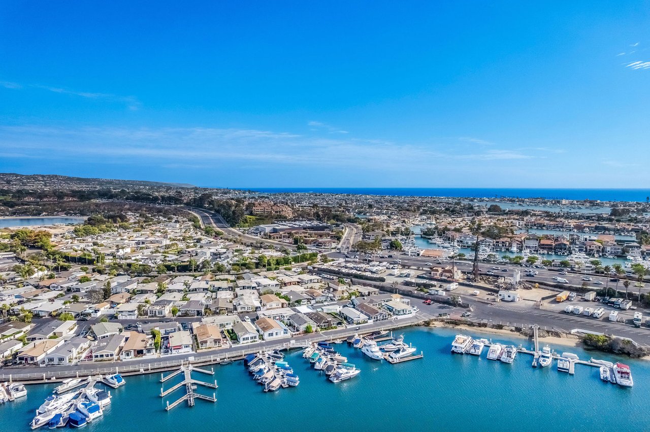
Newport Heights is a bluff‑top neighborhood in Newport Beach. It rises above Newport Bay and Mariners Mile along Pacific Coast Highway, with informal boundaries near Pacific Coast Highway to the south, East 16th or 17th Street to the north, Newport Boulevard to the west, and the bay and Dover Drive to the east. For a quick map view, check a simple neighborhood locator that shows the Heights perched above the harbor on the inland side of PCH.
The bluff location is the defining feature. City planning documents identify Newport Heights and neighboring Cliff Haven as bluff‑top areas with public outlooks and view corridors over the Lower Bay and ocean. That hillside position explains why certain streets and terraces capture wide water scenes while others feel more tucked in.
You do not have to own a view home to enjoy the outlooks. Public green spaces along the edge of the Heights provide everyday access to the bay panorama.
Bluff views are parcel‑specific. Orientation, elevation and tree lines matter street by street. If a view is high on your list, review sightlines in person at different times of day and note how the topography affects each block.
Map idea for your scouting day: Cliff Drive Park, Ensign Park, Kings Road Park, Castaways Park.
Newport Heights feels coastal and connected because the waterfront scene sits just below the bluff and neighborhood streets link you to daily needs without a long drive.
From many blocks, you can reach the harbor quickly for dining and boutique shopping. The curated waterfront at Lido Marina Village and the PCH stretch known as Mariners Mile bring marinas, seafood spots and marine businesses into your weekly routine. Explore the area map to see how these anchors sit next to the Heights and the bay.
When you want a quick brunch or a casual errand run, the 17th Street Promenade in adjacent Eastside Costa Mesa is a popular option. It is a short bike or short drive from many Heights blocks and offers a pedestrian‑scaled mix of cafes and shops.
Exact walk or bike times vary by parcel because of slope and block layout, yet central pockets of the Heights score well for walking and bicycling. That mix of calm residential streets plus nearby harbor amenities is a big part of the neighborhood’s day‑to‑day appeal.
You will see plenty of walkers, runners and cyclists using local streets and nearby multi‑use paths. City coastal planning emphasizes public access connections around the bay, and those routes make short trips on a classic bike or an e‑bike practical for harbor runs and waterfront loops.
Golf cart culture is most visible on Balboa Island and Lido Isle, where rentals and private carts are common. Newport Beach limits where low‑speed vehicles can operate, so if you are curious about cart life in the Heights, start by learning how it works on the islands and then check city rules before you buy or rent.
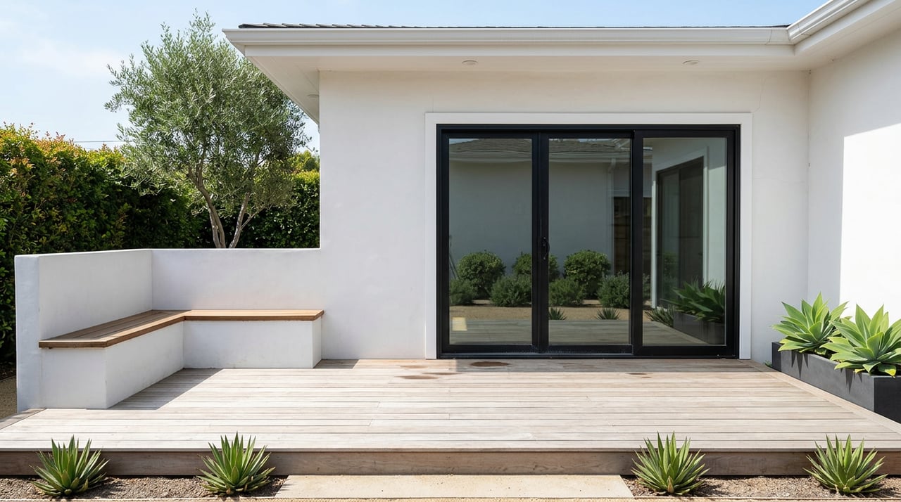
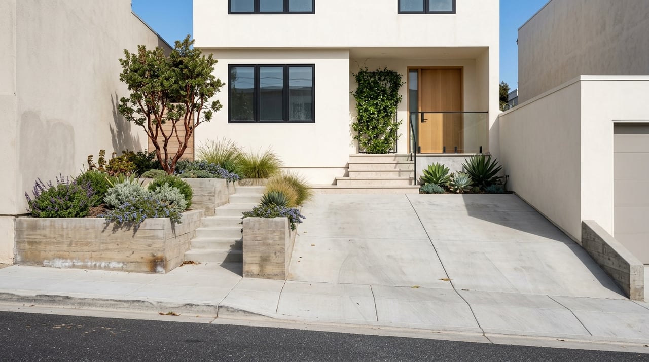
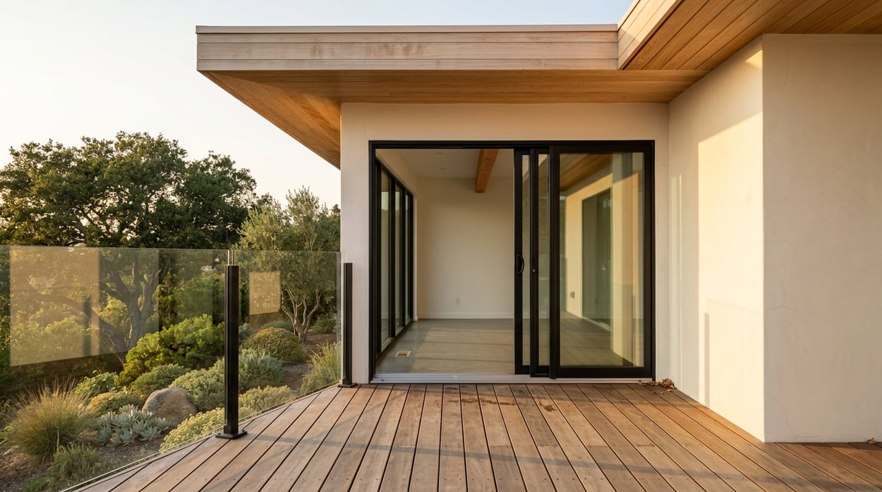
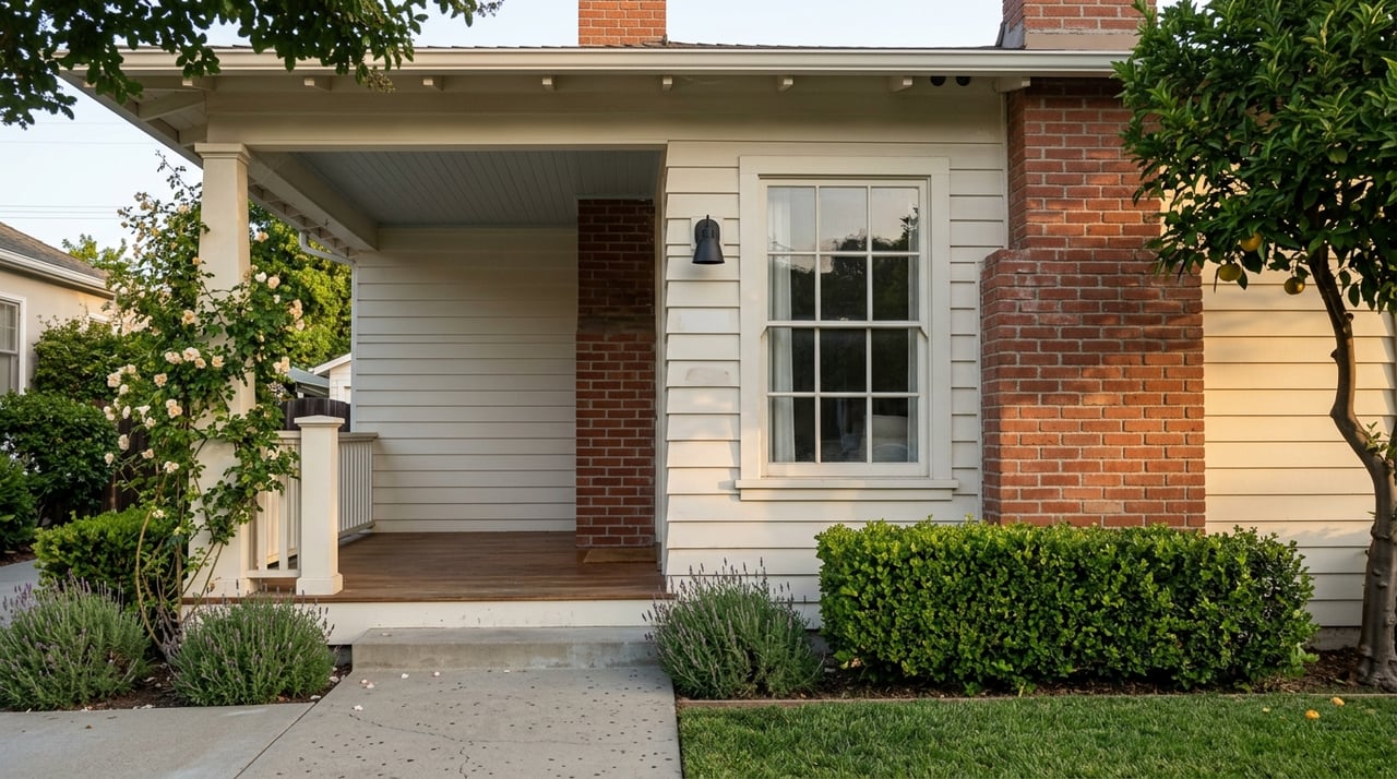
Newport Heights blends eras and styles in a photogenic way. You will find small cottages and mid‑century bungalows from the 1950s next to Spanish or Mediterranean remodels and an increasing number of coastal‑modern rebuilds. Interior streets often keep more modest footprints. Along bluff‑line streets like Cliff Drive and Kings Road, you are more likely to see larger custom homes and multi‑story view properties.
Lots here generally feel larger than the narrow parcels you see on the Balboa Peninsula. Alley access and rear garages are common in some pockets. Where you place a deck, balcony or roof terrace can make a real difference, since elevation and orientation decide whether you capture harbor sightlines or neighborhood tree canopies.
If you are thinking about a major remodel or a rebuild on a bluff‑adjacent lot, contact city planning early and speak with a qualified geotechnical engineer. Newport Beach has bluff overlays and setback rules that shape design and approvals.
If you are moving from Los Angeles or the Westside, the Heights checks several boxes that consistently attract relocating buyers. You get bluff‑top views from public parks and select streets, short walks or bike rides to waterfront dining and boutiques, and a quieter residential pattern than the Peninsula’s most active blocks. Access to John Wayne Airport is another practical perk that many residents cite as a quality‑of‑life win compared with longer hauls to LAX.
Newport Heights falls within the Newport‑Mesa Unified School District with nearby campuses commonly referenced in neighborhood guides. Always verify current school boundary assignments with the district before you buy.
Published medians can look different based on source, date and how each site draws the map. Active listing medians often skew higher if many bluff or view homes are on the market, while closed‑sale medians can blend a wider mix of interior properties. The takeaway is simple: use live, like‑kind comparables and a local lens when you price, buy or sell.
If you are sizing up a move, pair on‑the‑ground neighborhood context with current data. A quick street tour of the bluff edge, a lap through Lido Marina Village and Mariners Mile, plus a look at your daily 17th Street errands will tell you a lot about lifestyle fit. Then compare recent sales for your micro‑pocket. A well‑staged, well‑priced listing still commands strong attention here.
Walk or bike the blocks that interest you at different times of day. Listen for traffic near PCH and Newport Boulevard, feel the afternoon breeze on the bluff, and check how shade and sun hit potential outdoor spaces.
If you plan to use an e‑bike for quick errands to Lido or 17th Street, ride the exact routes. Confirm where you will store bikes at home and how you will charge them.
View claims change within a block. Stand on the property, look toward the bay or ocean, and note what a second story, deck or glass railing could add. Confirm any plans with the city and understand height limits and setbacks.
If schools are a decision factor, verify current assignments with the district rather than relying on third‑party maps. Boundaries can change.
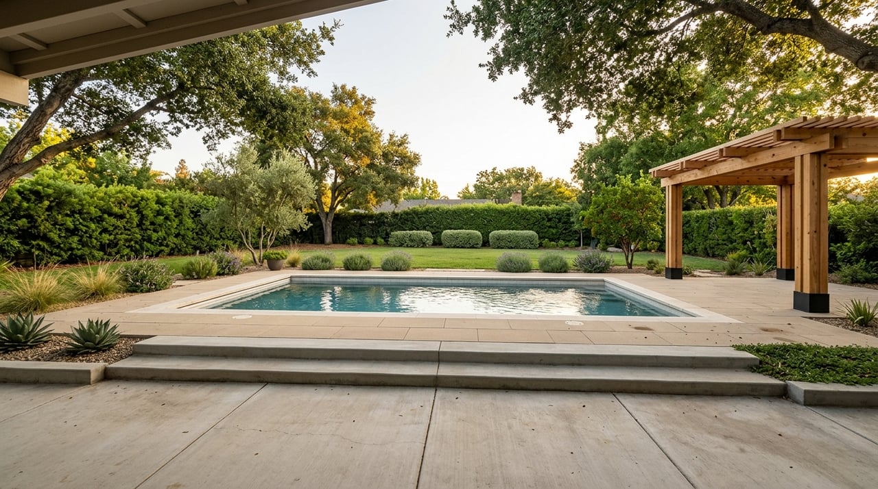
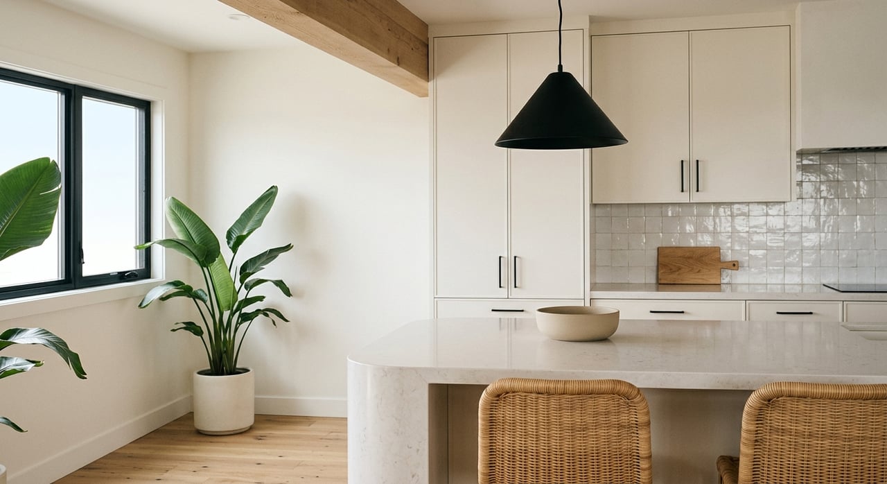
Buyers choose the Heights for coastal access, outlook parks and easy daily routines. Use photography that tells that story: morning light in an open living space, a quick walk to coffee, sunset glow on a deck, and a bike parked by a clean mudroom.
Simple, light coastal styling, clear walk paths to patios, and uncluttered window lines help buyers feel the space and the bluff air. If you have even a peek view, arrange furniture to draw the eye toward that window or terrace.
Presentation changes outcomes. An agent who owns the staging process can reduce delays, keep the narrative tight, and help your home photograph and show at its best. That often improves buyer engagement and supports a stronger final price.
If you love the idea of a walkable, bluff‑top neighborhood with quick harbor access, Newport Heights deserves a look. Tour the outlook parks, grab a bite by the water, and then imagine your daily routine from a quiet street above it all. When you are ready to discuss timing, value, and how smart staging can elevate your sale, reach out to Cassie French for a free home valuation and a design‑forward staging plan.


Enthusiastic, upbeat, and energetic, Cassie French's passion for the Newport Beach & North Tustin community shines through every interaction and transaction. Part of The Agency Orange County, Cassie's fresh perspective pairs beautifully with her commitment to excellence and extensive knowledge of the area to provide clients with unmatched guidance and care.
3426 East Coast Highway Newport Beach CA